Sunday, June 24, 2007

Summer 2007 Tour - Day 16

Day 16
Sunday, June 24, 2007
Austin, TX to Cypress, TX
163 miles


I left Austin late in the day after a morning of sightseeing and exploring. The dash up US-290 was uneventful. My mom came out of the house as I pulled into the garage and admired my bug-encrusted BMW. That night over dinner, we finally dared to joke that this was my first incident-free long tour in a long time.

Trip Costs:

Gas: $393.90
Food: $139.59
Lodging: $592.04
Misc/Petty Cash: $285.89

Total: $1411.42

Mileage: 6089
(from Mapsource, GPS was inaccurate and my odo was waaaaay off)

Saturday, June 23, 2007

Summer 2007 Tour - Day 15

Day 15
Saturday, June 23, 2007
Van Horn, TX to Austin, TX
463 miles


The interstate exit at Van Horn, TX is all screwed up.

I could see the inviting sign for McDonald’s and my morning coffee and yogurt right on the other side of I-10. I headed south towards what looked like the underpass and instead found myself trapped into getting onto I-10 west!

Being in west Texas, the next town was about 30 miles away, so this was a serious situation. It was around five miles down the road before the first exit appeared, an unnamed ranch access road. I exited and passed under the interstate through a barely one-lane wide tunnel on a barely maintained paved road. With a burst of speed, I re-entered the freeway and headed back to Van Horn, finally obtaining my breakfast about 20 minutes after leaving my motel!

The southernmost east-west interstate is very familiar to me, after several recent Texas crossings. I settled into my saddle for some serious mile-eating.

Four hundred miles later, I left I-10 just east of Junction, TX. I had never ridden this segment of US-290 and it was a welcome change of scenery.

Fredericksburg, TX with it’s German restaurants, quaint shops, and peach stands was interesting to ride through although with all the traffic, I‘m not sure I‘d care to spend much time there. I always enjoy history, so Johnson City and LBJ Historic park might be worth a stop sometime when I’m not hurrying home from a large trip.

I’d been hearing from my parents and boyfriend that Texas had been enjoying some especially crappy weather while I’d been out enjoying all the spectacular scenery and blue skies that the West had to offer. The weather started to look threatening as I approached Austin, TX. When the first rain drops hit, I decided to enjoy the coolness and continued riding instead of stopping to zip up my jacket vents.

A classic Texas pounding rainstorm hit me as I rode the overpass from US-290 to the Mopac in Austin. I was dripping as I geared down to greet my boyfriend in the parking lot of our hotel.

Friday, June 22, 2007

Summer 2007 Tour - Day 14

Day 14
Friday, June 22, 2007
Safford, AZ to Van Horn, TX
419 miles


A pack of sport bikes passed me as I backtracked east on US191 this morning. I watched wistfully as they made the turn to head north on the Coronado Trail and I continued east on AZ-78. It was very hot, so I was glad to find that 78 attempted to mimick both US191’s cool elevation and twistiness with a very desert-y flair of it‘s own.


I made my way south on US180 to Silver City, NM where dark clouds and lightning strikes ahead encouraged me to take an early lunch. I sat down to an eggplant sandwich with sweet potato fries at the Adobe Café while thunder shook the building.

Gearing up, the dark clouds around me told me that thought that particular storm had passed over, I would still have lots of cells to worry about.

Following a line of vehicles down NM-152, I anxiously watched the sky and the GPS. I told myself that I would stop if the route seemed to take me through an area with active lightning. Somehow, it seemed to keep missing storms, gently easing away from black cloud areas.

I was less sure of my decision to continue as I passed San Lorenzo. The road narrowed, traffic disappeared, and curves began. It was raining and I was on a tight mountain road.


I kept looking for that ethereal break in the clouds….. The place which I had to reach to get out of the storm. The road would tantalize me with a view of it… and then swoop away.

Hyper-aware of the slippery conditions, I rode cautiously. Deep turns that might normally be worthy of a WAHOO! got barely any lean.


I passed several interesting rock formations and beautiful vistas. I would have stopped, but I generally try to avoid exposing my camera to rain.

I was hugely relieved upon reaching I-25. It had been a stressful morning and I was very ready for the soothing ease of interstate riding.

Reaching Las Cruces and my turn east, I saw dark clouds hovering over my next mountain range. I stopped for gas to consider the situation. The mountain range ahead was somewhat familiar. I had ridden it in April with a group from Sport-Touring.Net. I really had no pressing need to ride it again in a storm.

Decided, I got onto I-10 and resigned myself to getting as far as possible into Texas before stopping for the night.

I think Mother Nature really wanted to throw some freakish weather my way, because there was a major dust storm going on in El Paso. The sky was brown and the wind strong.

Bottles, cardboard, lumber, and all sorts of miscellaneous trash was getting tossed around the freeway. At one point as I rolled down the left lane, the center lane played host to a rollicking horde of tumbleweeds. I eyed them cautiously and hung back with the rest of the cars before passing them in a quick burst of speed. A few got me, but I got them back. Looking in my mirrors, where one large tumbleweed had been, three little ones remained.

When the speed limit changed, I ramped up to just over 80mph. The ride across west Texas was mostly uneventful. The only really bright spot was the frog-strangler that hit just as I was going through the Border Patrol checkpoint.

I checked into an inexpensive hotel in Van Horn, TX and followed the clerks recommendation to a local Mexican restaurant for dinner.

Thursday, June 21, 2007

Summer 2007 Tour - Day 13

Day 13
Thursday, June 21, 2007
Williams, AZ to Safford, AZ
442 miles


Having eaten only fruit salad and fruit juice the night before, I was happy to get back to my normal yogurt and coffee prior to starting off the day on I-40.

Reaching Flagstaff, I headed south on US-89Alt to Sedona. I was somewhat disappointed to find more Native American bazaars at every overlook point. Makeshift booths full of wares lined the walkways, making it hard to get great shots of surrounding landscape.


Just north of Sedona, I enjoyed the views of Slide Rock State Park but didn’t enjoy the traffic. I had no qualms over skipping a dip in the famous swimming hole.


The town of Sedona itself appeared to be a lovely place to while away an afternoon. Cute shops attracted hordes of tourists without feeling kitschy. There was lots of construction in the area, with red dust drifting over the road in many places.


After a short stint on I-17, I headed east on AZ-260. The ride was mostly unremarkable with long portions of busy slab through hills around Payson. It was very hot. I stopped often to refill my camelbak and even took a short break for some gas station soft serve ice cream.

I began to take interest in my surroundings again while riding through the foothills of the White Mountains.


Late in the day, I turned onto the most anticipated road of my day, US 191, the Coronado Trail. It was past 4 PM and I had around 150 miles to go.


The main thing I’ll say about US191 south from Alpine, AZ is that it was a whole lot of work.

I love these kind of roads…. Slow turns, switchbacks, curvy runs down shaded forest paths. I was doing a whole lot of back and forth transitioning.


It was high elevation, so cooler than it had been in the heat of the day. I went through a few areas that had seen recent rain (judging from the wet pavement) but saw no rain myself.


I was constantly worrying about making it out of the mountains before sunset, but I just HAD to stop whenever I saw a great photo-op.


Too many pictures…. Yeah.


Reaching the area of the huge open pit Morenci Copper Mine, I was shocked by the contrasting landscape. The largest (in total output) copper mine in North America, Morenci covers 60,000 acres.

After rock has been crushed and copper removed, it is put back in place. These terraced “benches” are all that remain of the mountains in the area.


US191 wound through Morenci and the very obviously company town of Clifton.


Finally getting out of the hills, I enjoyed the sunset and braved the heat of the desert plains on my approach to Safford.


I parked the R1200ST next to several large mining trucks at the Econolodge in Safford.

Wednesday, June 20, 2007

Summer 2007 Tour - Day 12

Day 12
Wednesday, June 20, 2007
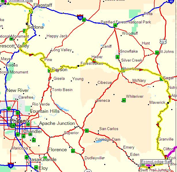
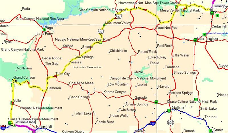
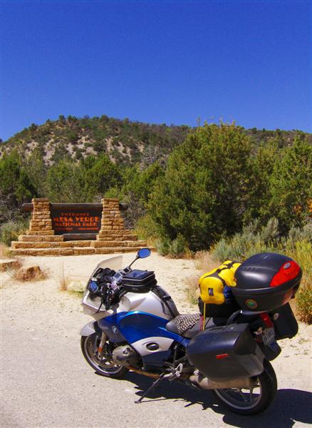
Durango, CO to Williams, AZ
454 miles


As always seems to happen on those days when I most desire an early start…well… it didn’t happen. I decided to skip breakfast and just hightail it west to Mesa Verde National Park.


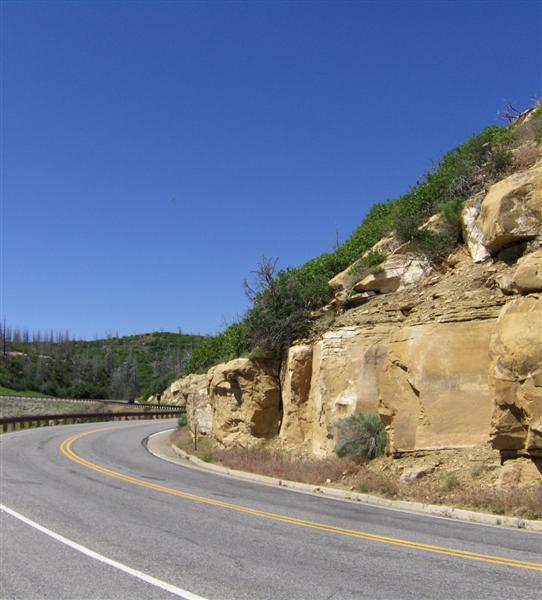
Some ominous road construction signs outside the park were making me nervous, especially the one that said “Motorcycles Use Caution.” The gate attendant reassured me that the roads were easily manageable.


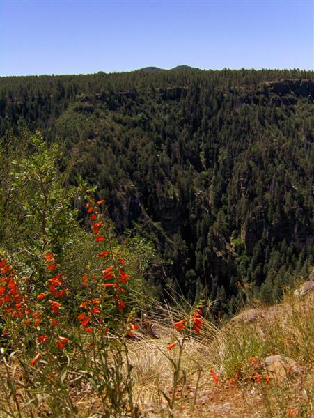
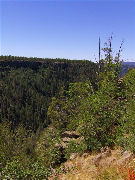
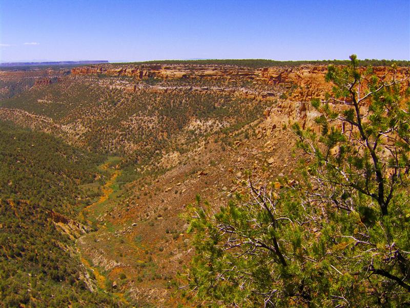
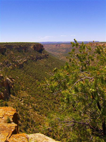
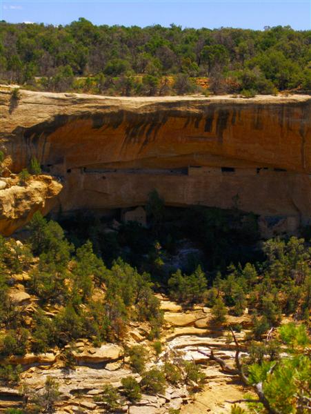
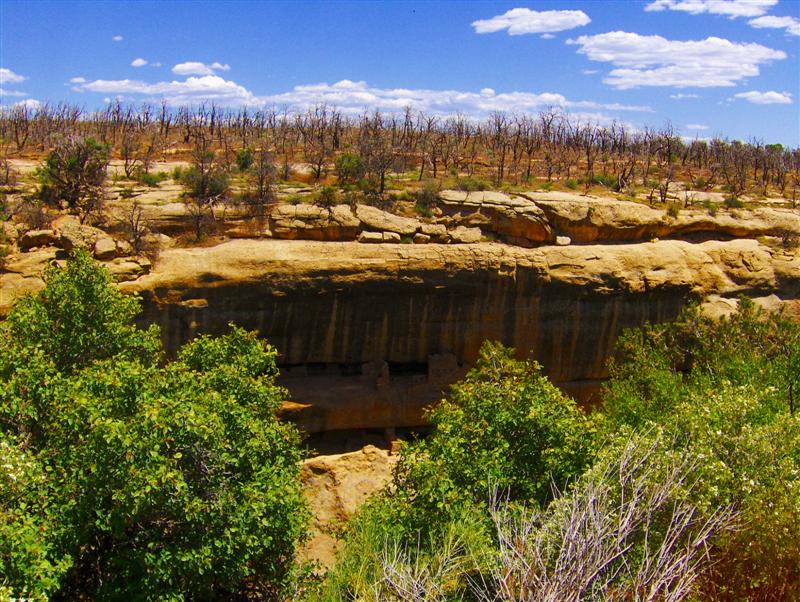
After a quick stop at the visitor’s center, I headed down the park road to the “Mesa Loop”. I didn’t have time to actually hike down to one of the cliff dwellings, and a ranger at the visitor’s center said that the loop was the best way to quickly experience the park.

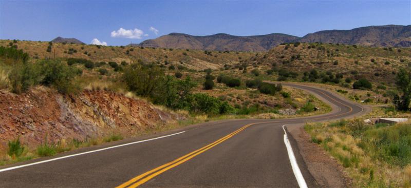
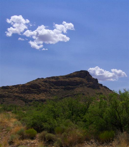
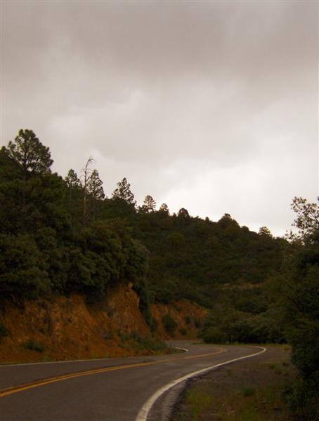
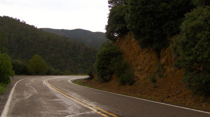
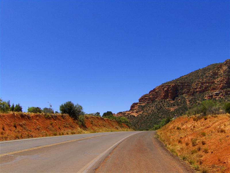
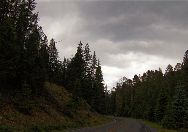
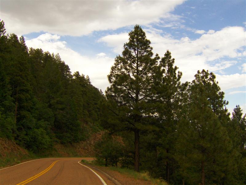
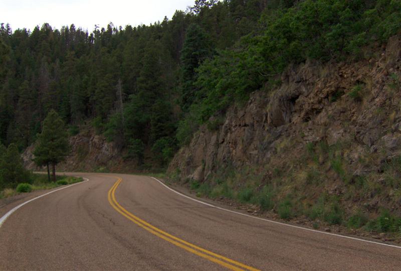
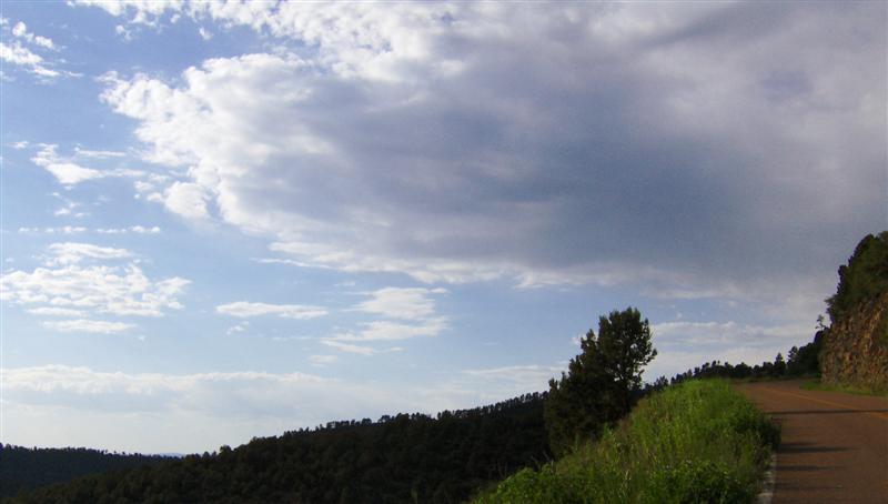
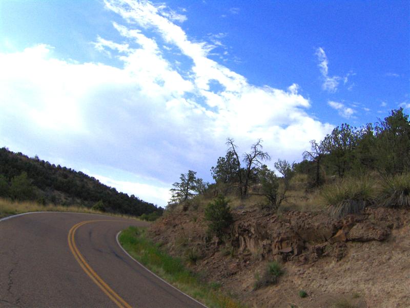
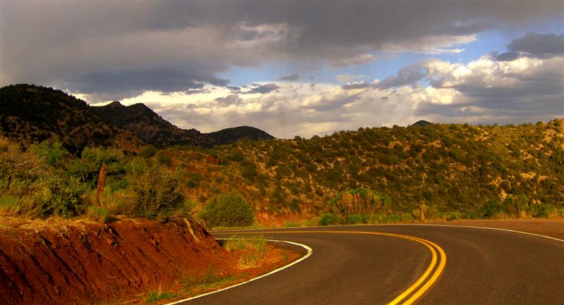
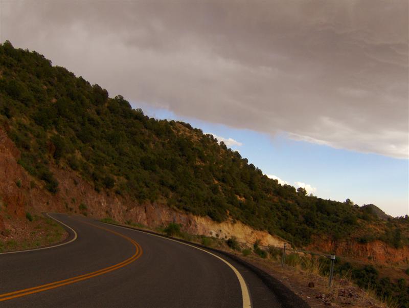
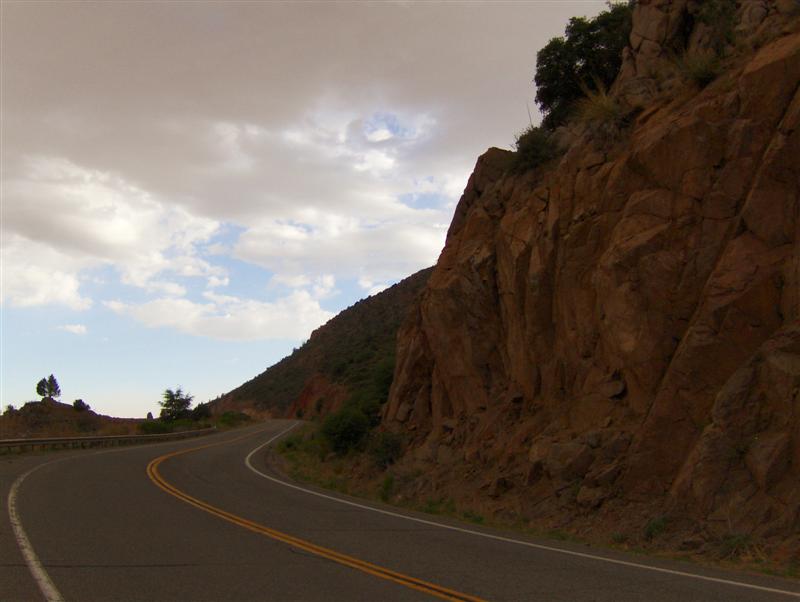
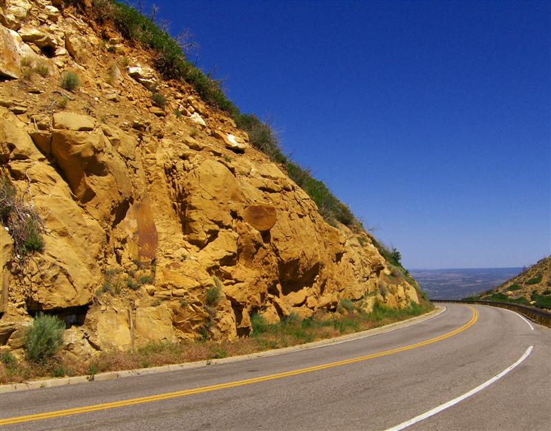
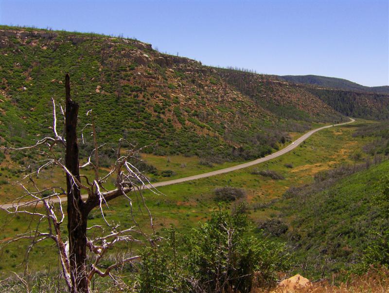
The road toward the loop was very much under construction. I used to say that the worst rain grooves I’d ever experienced were on US101 just north of Los Angeles. These were FAAAAAR worse. Initially I was taking it slow and cautious until I realized that a little bit of speed smoothed things out nicely.

It was hot. Walking around the “Pit Houses” (early structures built by the Indians who lived in the area), I was constantly sipping from my camelbak. I was making lots of quick stops, so it made no sense to remove my helmet and gloves.


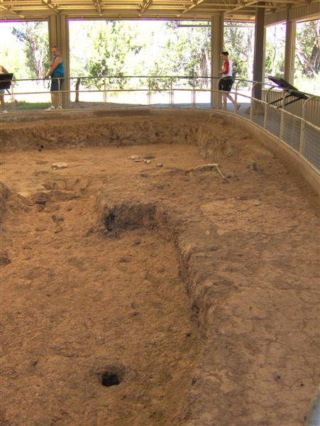
Interestingly, the Indians didn’t construct the famed cliff dwellings until very late in their occupation of the area.


It was just past noon by the time I got to Cortez. I had a quick lunch before dashing west.

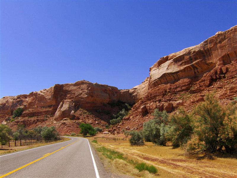
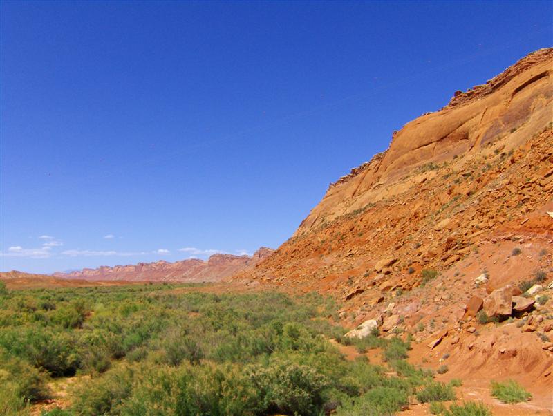
My big goal for the day was to make it to the Grand Canyon while there was still light to see. With this in mind, I decided to skip the big tourist trap at Four Corners. I crossed into Utah on scenic UT-262.


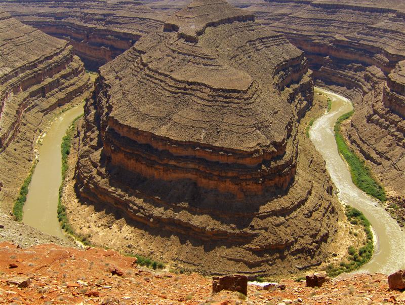
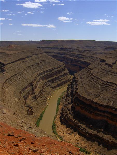
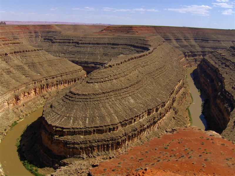
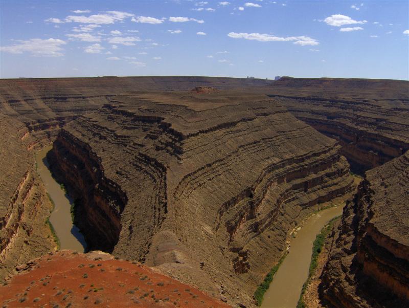
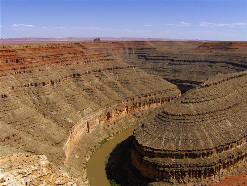
I turned north on UT-261 for a brief visit to Goosenecks State Park. The view at the end of the park road was spectacular. The winding San Juan River has managed to entrench itself 1000 feet below ground level in an ever-deepening canyon. I’ve never seen anything like it!


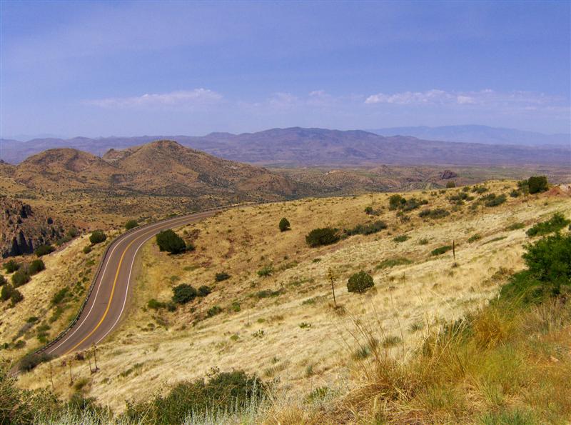
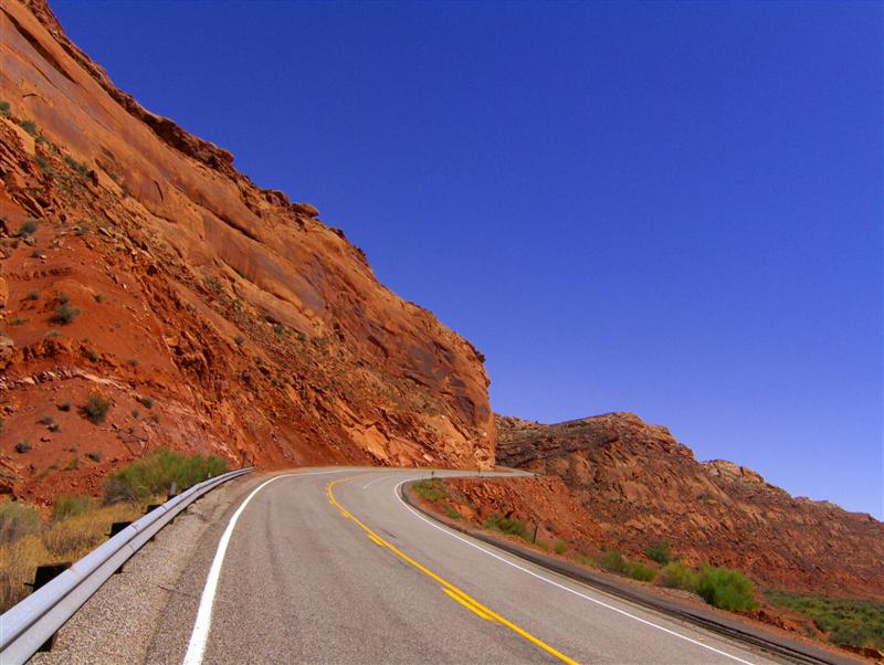
Returning to UT-261, I carefully turned south. Just a few miles north was Mokee Dugway and the infamous 1100 foot descent over three miles of steep unpaved switchbacks. Perhaps someday I’ll be back with a more capable motorcycle (or rather, a more capable Rocketbunny).

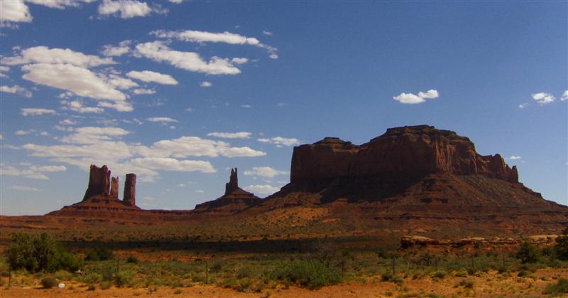
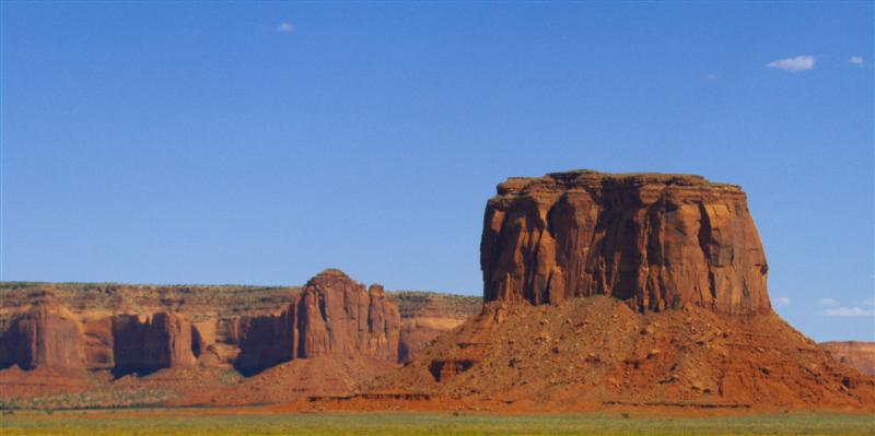
Heading southwest on US-163, the unmistakable sight of my next trip highlight soon appeared in the distance.


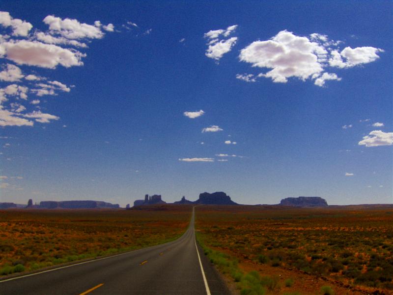
The mesas and buttes of Monument Valley have been photographed countless times. I felt somewhat sheepish adding my clicks to the multitude.


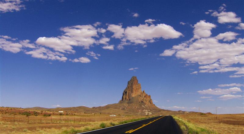
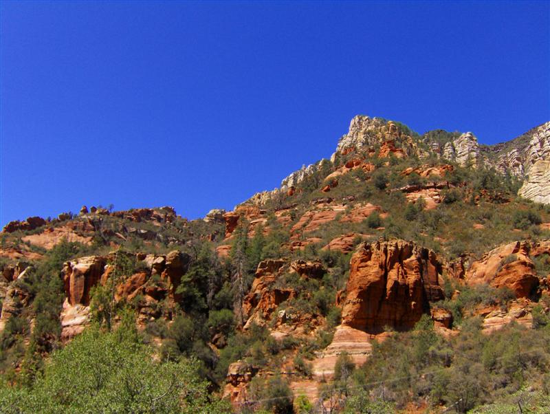
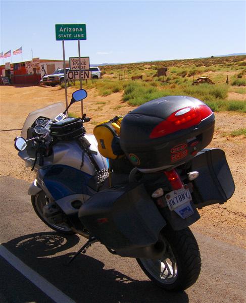
I crossed into Arizona at Mexican Hat. This state line crossing was more exciting than most because Arizona is one of my “missing” states….that is… a state that I’ve driven through but never RIDDEN through.

It’s really a shame that the scenery at the state line consisted of a Native American bazaar.


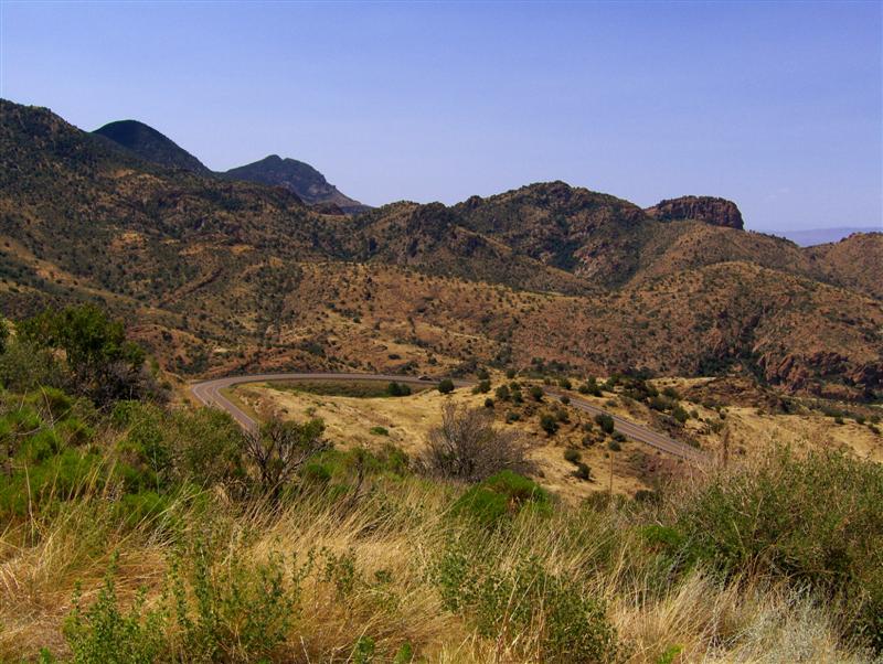
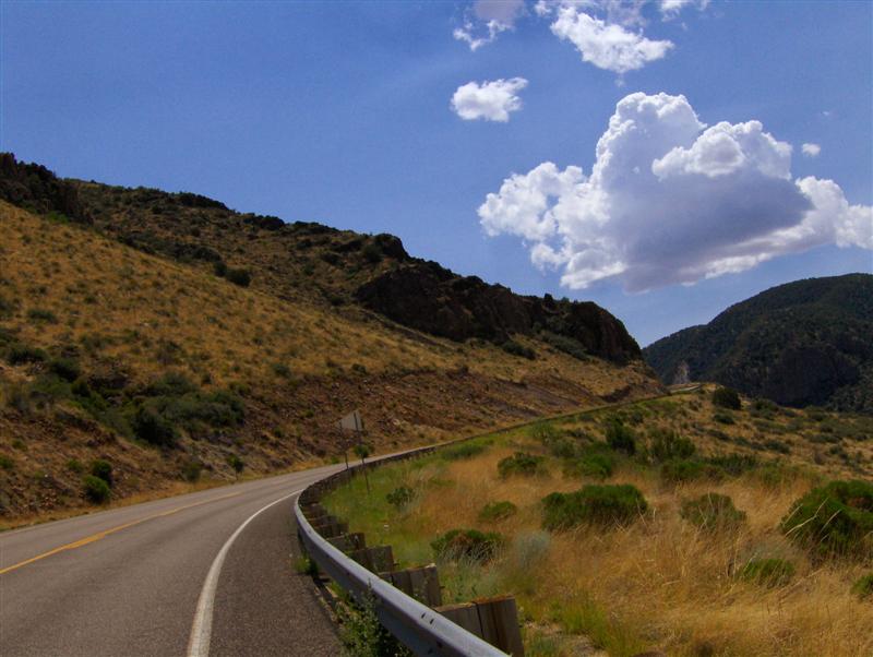
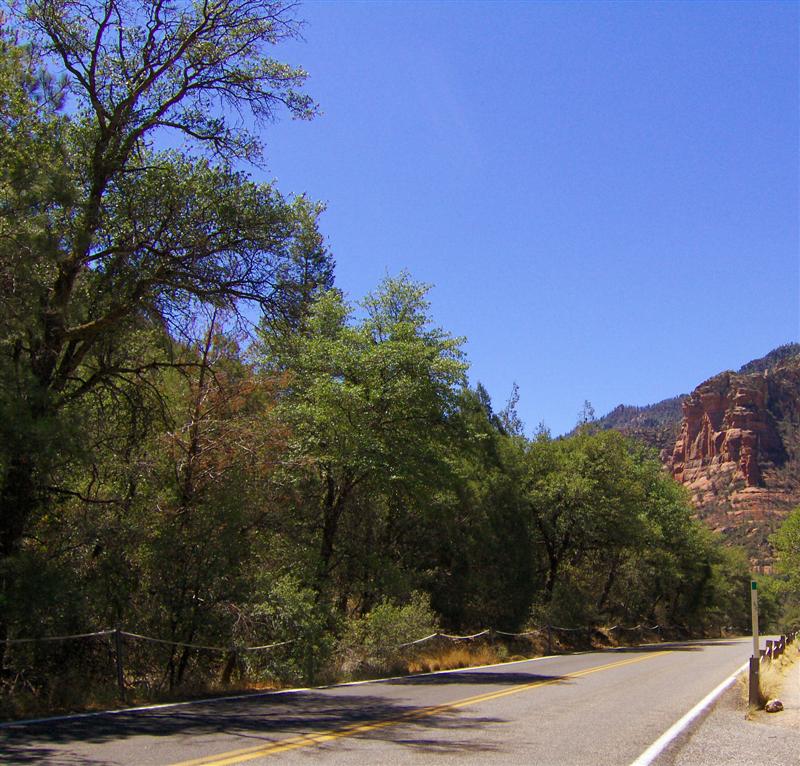
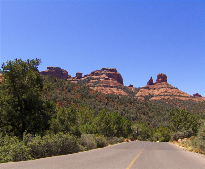
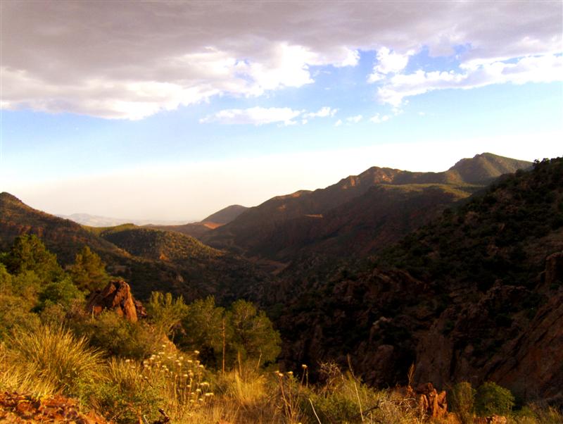
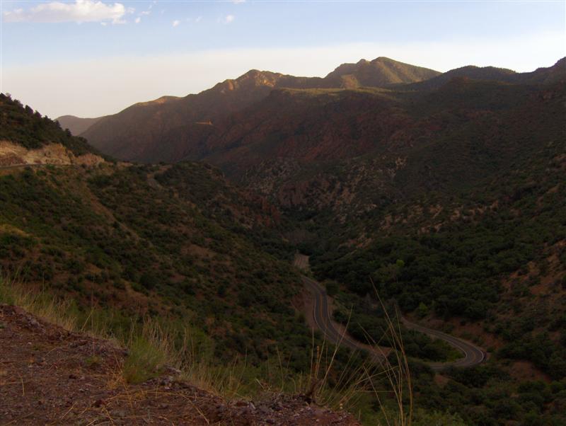
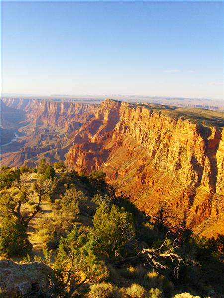
From that point, the ride was mainly just a race to get to the Grand Canyon during daylight hours. The ride in was tantalizing, with glimpses of the beginnings of the canyon to the north and the sun inexorably setting to the west.

I paused to take a deep breath at the entrance to the park…. Before crossing roughly 100 feet of dirt to get to the gate (under construction!).


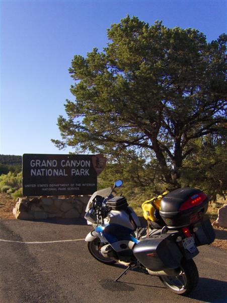
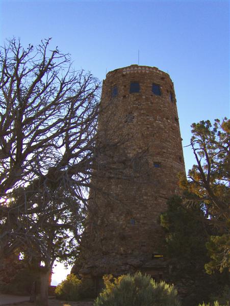
Just past the entrance, I parked the R1200ST in a half-full parking lot at Desert View and carefully stowed my gear. I grabbed my camera and walked down the path, passing the 1933 Indian Watchtower, a combo gift shop, visitor’s center, and fire lookout tower.


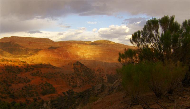
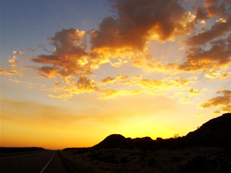
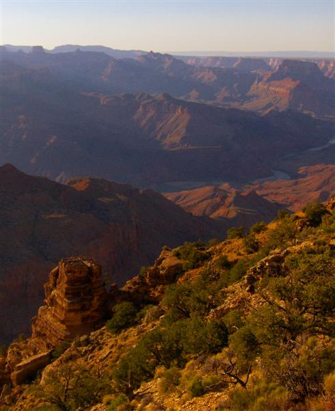
The canyon was glorious at sunset.

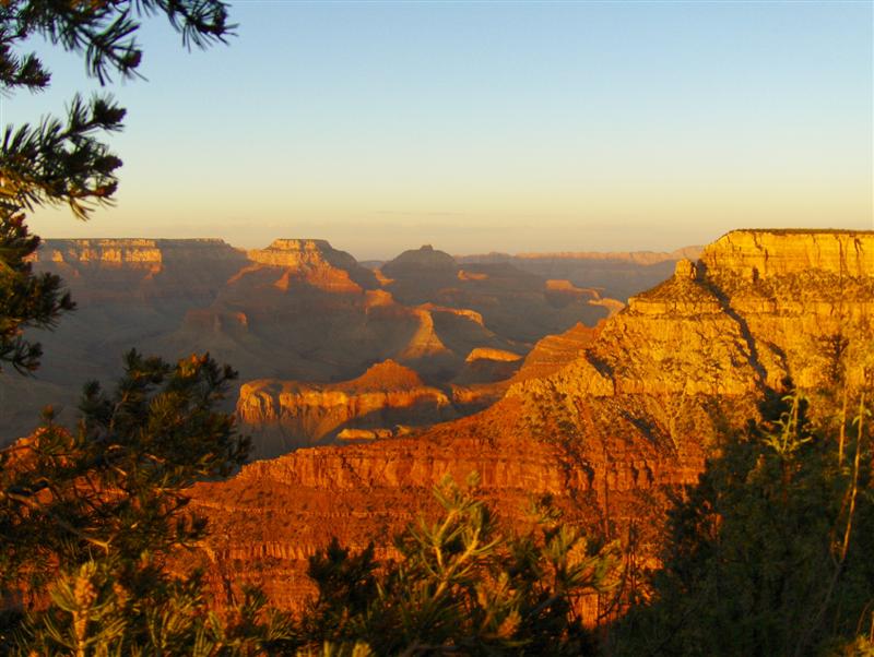
To the west, layers of rock in shadow…


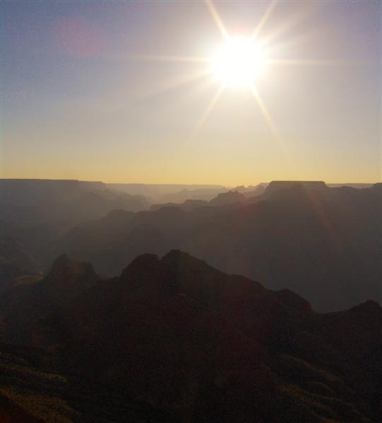
To the east, bold warm colors…


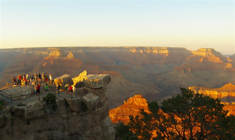
After a quick stop into the gift shop, I rode west to Canyon Village and another view.


I decided not to take the time to walk out onto this viewpoint, but it brought back some memories.

I was last here in late November 2004. My boyfriend of the time had never seen the Grand Canyon. We were headed to Texas for Thanksgiving and decided to make the 80 mile round trip off the interstate.

The snowflakes coming down as we drove up the access road should probably have told us something. Arriving in the deserted parking lot, we carefully walked out onto the viewpoint (very icy).

I stood there and ruefully told him, “Right there, stretched out before us is the most amazing, thrilling view of the Grand Canyon…. Trust me!”

The canyon was a white-out that day and he got his views of it from a large panoramic picture in the visitor’s center where we went to warm up.


With my 2004 trip on my mind, I wasn’t terribly concerned about the ride south to Williams, AZ. The sun had officially set (according to the GPS) by the time I was halfway down what was in my memory as a fairly straight road.

As it got darker, I realized that the shine of my headlights was far too white. I stopped to look and found that the halogen headlight in the top slot had blown and I was running only on the HID in the lower slot.

I found a car to light my way and continued to Williams, where I a found a hotel room and satisfied a strange craving for fruit.